I love flying! All of it… Even sitting on the tarmac waiting to take off in 100° heat because I know that soon I will be free from gravity and soaring through the skies. (This wasn’t one of those hot days.)
Today was my long cross-country flight over places I’ve never flow over to airports I’ve never flown to. I was all set, I had my flight plans, I had good visual way points about every 10 miles, I had looked at my route on Google Maps to get a feel for what the route looked like from the air, my GoPro, GPS, and tablet were all charged up, my flight plans were loaded into my tablet, I had paper versions of my flight plans just in case the tablet decided to take a break, and I had my paper charts with the routes marked on them and folded to the right sections.
I went to church in the morning and then home to change clothes, grab a quick bite to eat (a couple PBnJ sandwiches and a small bag of Lays Chips), grab my flight bag and head out to the airport. The weather along the coast was IFR in the morning but by 1pm when I was scheduled it had cleared up. According to my flight plans I would have an extra 1:10 of fuel left when I got back to CNO, but I had them put an extra 3 gallons in each tank just for a little added cushion. I finished the pre-flight, settled in, and started up the engine.
After receiving my taxi clearance I taxied out to the run-up area. Everything looked good on run-up so I was all ready. MY CFI had given me the okay for a slight detour to fly over my house in Yorba Linda on my way so I sent my wife a quick text to say I was about to take off and would be over the house in about ten minutes. I contacted the tower, they gave me my squawk for Flight Following, and after a quick wait for a plane on final I was given my clearance and was on my way.
Very quickly after takeoff I was handed off to SOCAL Approach.
Me: “SOCAL Approach, Cherokee 5800Uniform, 2 miles west of Chino Airport, 1,400′, climbing 2,500′.” (The tower had restricted me to 2,500′ because CNO sits under a 2,700′ shelf of ONT’s airspace)
SOCAL: “Cherokee 00Uniform, what altitude are you requesting?”
Me: “I would like 3,000′ for now and I have a slight detour on my route to POXKU before navigating north along the 57.”
SOCAL: “So, you want to navigate along the the 91 and take the VFR transition over LAX?”
ME: “No, I just want to fly over Yorba Linda and then north along the 57 to the 210.”
SOCAL: “Ok, just remain at or below 4,000.”
I climbed to 3,000′, headed towards my house and was handed off to the approach for LAX’s Class B airspace. My house sits south of LAX’s airspace but once I turn north I would be flying under the 7,000′ shelf of LAX’s airspace.
SOCAL: “November00Uniform, contact approach on 134.9, talk to you soon.” (He knew that I would be transferred right back as soon as I was out from underneath LAX’s airspace.)
Me: “134.9, 00Uniform.”
(Make the frequency change)
Me: “SOCAL Approach, Cherokee 5800Uniform, level at 3,000′.”
SOCAL: “00Uniform, roger.”
By now I could see all the areas around the house that I know so well, including the school next to my house and headed towards it. As I got closer I banked just a little bit and looked down to see my wife and two kids out standing in the driveway. I went to grab my camera off the right seat to take a picture of them but just then SOCAL starts talking to me. (Later I learn that my dear sweet wife had taken pictures of a helicopter and a different plane, not me… In her defense I did not fly directly over the house.)
SOCAL: “Cherokee 00Uniform, change heading to 120.” (I had already made my turn and was heading 320° to angle towards the 57 freeway before turning north.)
Me: “Negative, I want to fly to the 57 freeway before turning north.” (Mind you at this point I was 8 n.m. away from the 4,000′ shelf of LAX’s airspace and 17 n.m from where I would have busted into the 2,500′ shelf if I remained on my current heading at my current altitude.)
SOCAL: “00Uniform, change your heading to 120°”
Me: “I want to navigate to the 57 freeway before heading north.”
SOCAL: “Where are you flying to?”
Me: “Camarillo”
SOCAL: “Okay, resume VFR navigation.”
Me: “Thanks, resuming navigation, 00Uniform.”
My first time telling a controller that I wanted to do something completely different than what they wanted me to do. A couple minutes later and I asked to climb to my cruising altitude of 6,500′. They gave me clearance to 6,000′ (I’m sure to keep a cushion below the 7,000′ shelf so I began my climb. Shortly after that I was passing out from under their shelf, I was given the clearance to climb, and handed back off to the other Approach.
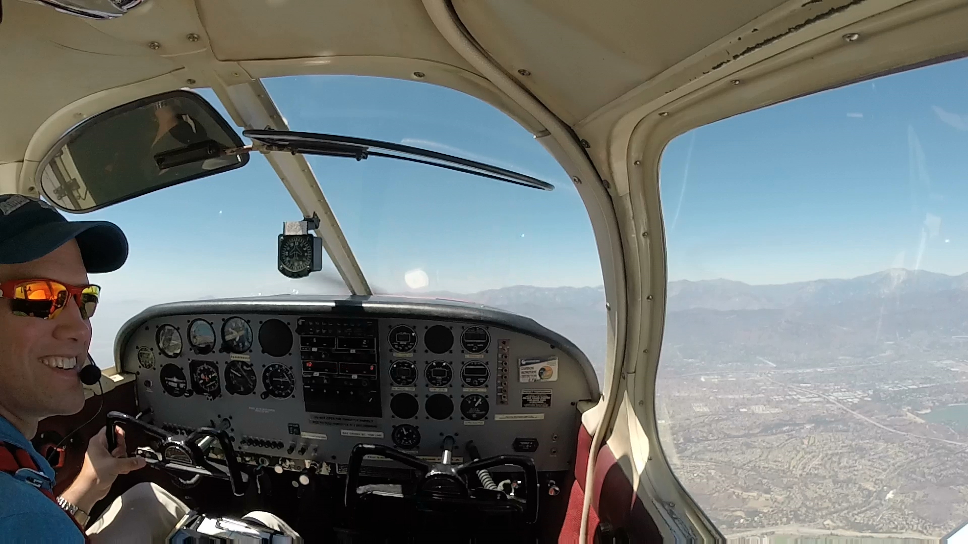
Just after flying over my house, having a great time!
Me: “SOCAL Approach, Cherokee 5800Uniform, level at 6,500.”
SOCAL: “00Uniform, welcome back.”
The rest of the flight to CMA was easy enough to navigate. Before I would get to my checkpoint I could see the next two on my list. I played around with my tablet a little bit, not really for any navigation, but just to get more familiar with the functions of the flight app. There was another student of my CFI doing his long XC and I heard him on the radio and saw him go by the opposite direction 1,000′ below me. He left an hour before me but I’m not sure where he had gone on his flight.
I flew past the Rose Bowl, Dodger Stadium, LA, and the Reagan Library. After the flights down to Ramona and Palomar, it was cool to see these other landmarks.

Rose Bowl
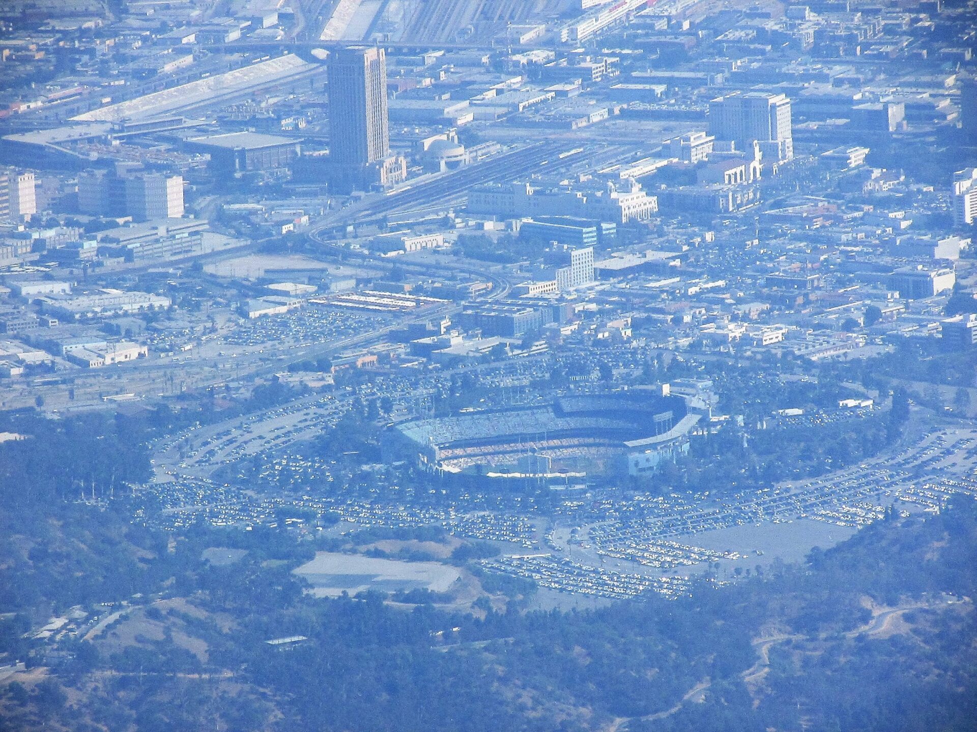
Dodger Stadium
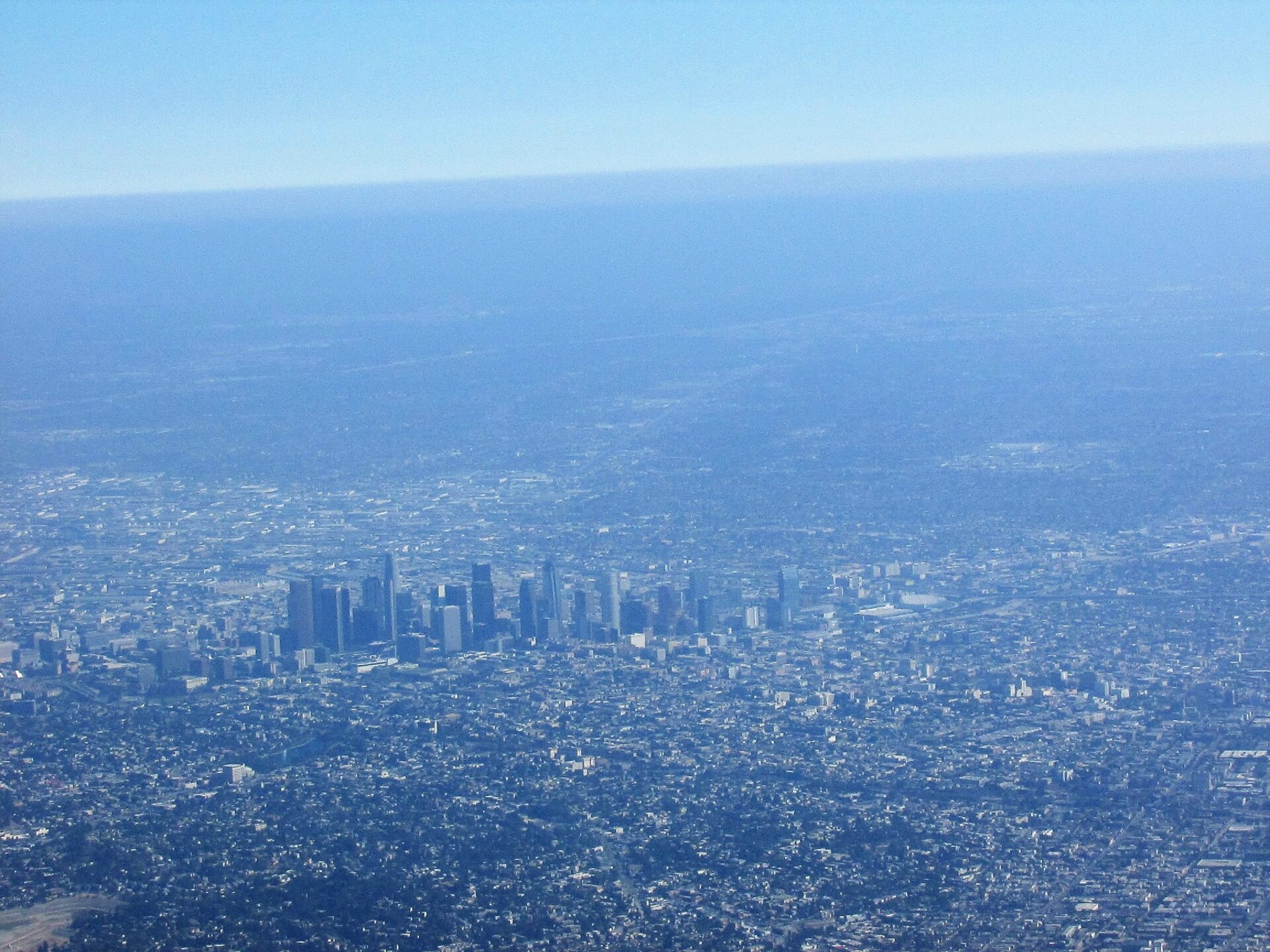
Downtown Los Angeles
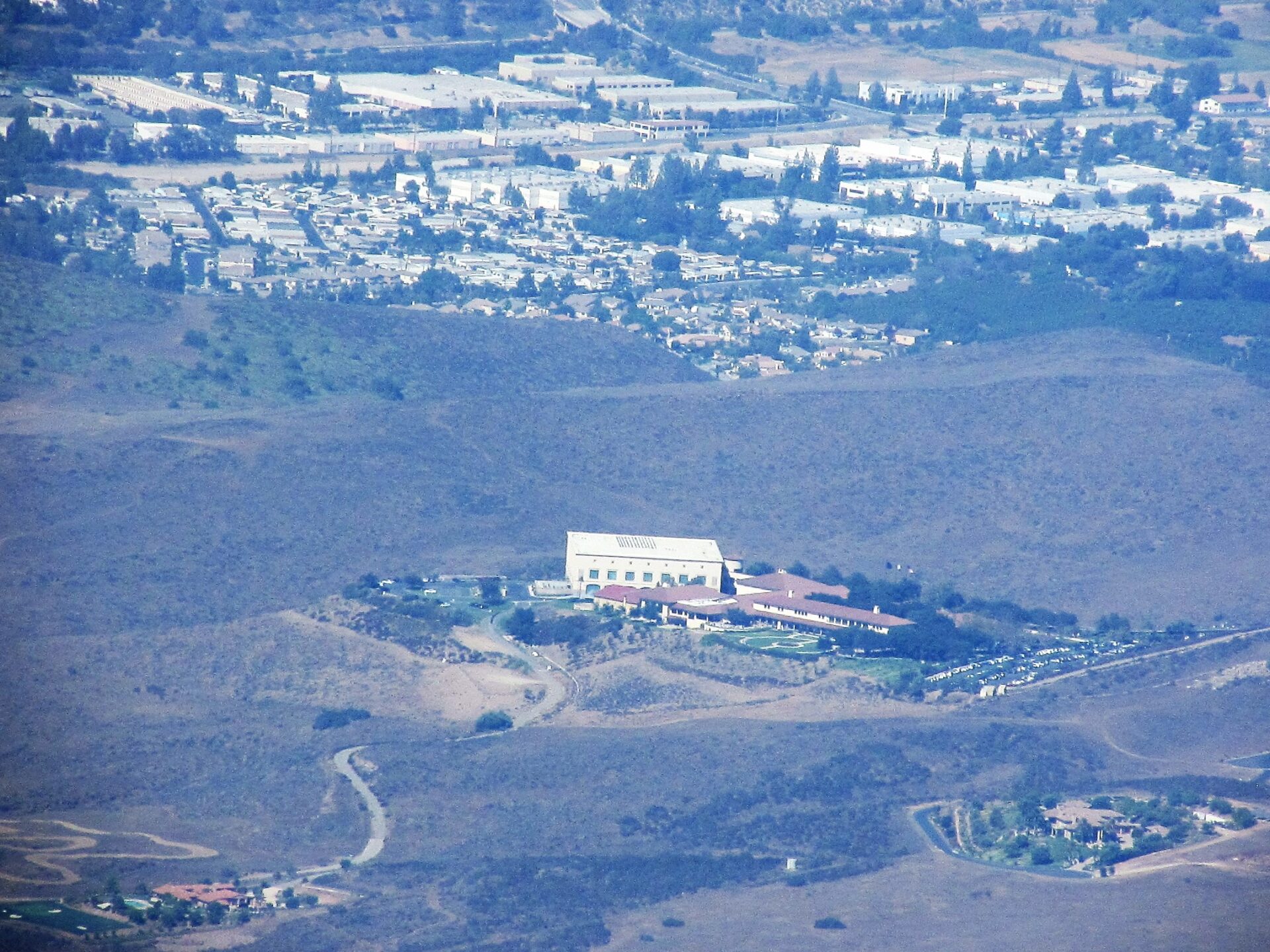
Reagan Library
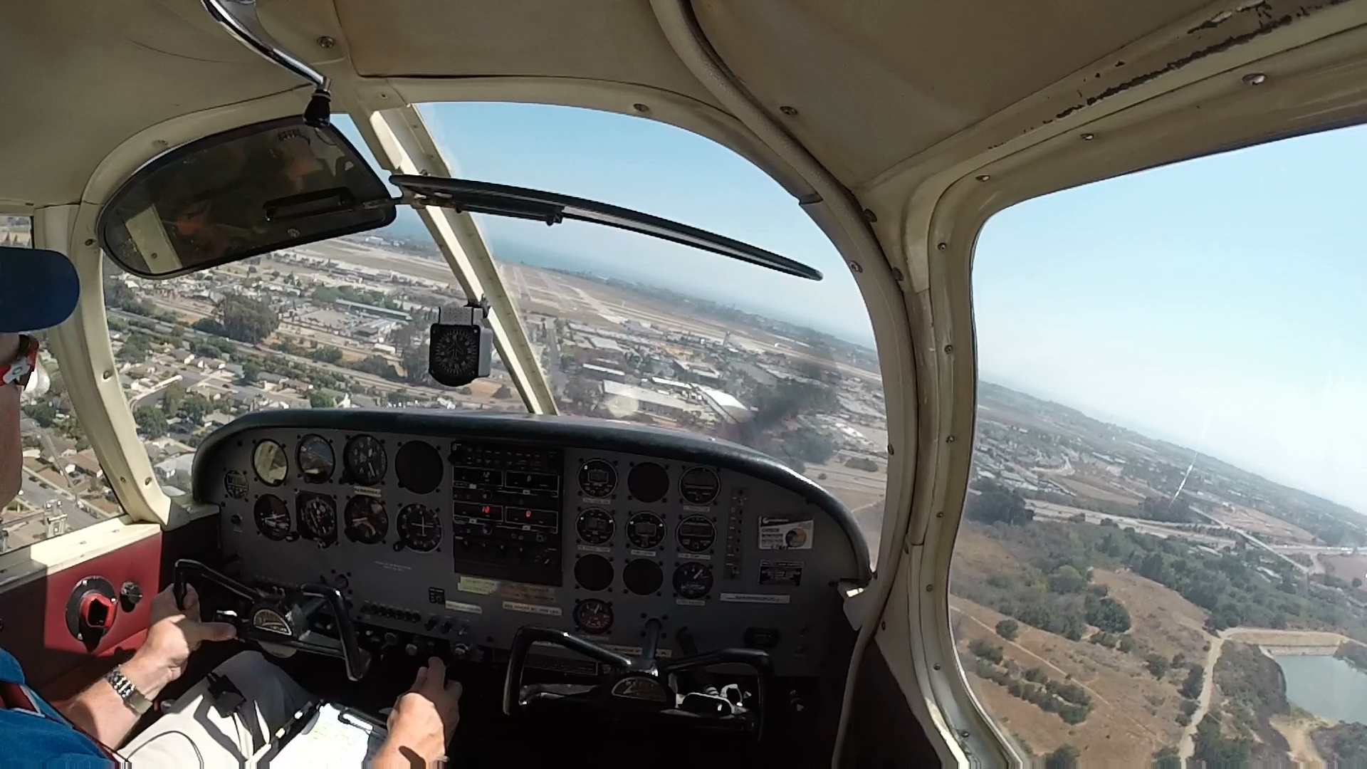
I was handed off from one controller to the next and finally was making my request to begin my descent. After receiving clearance I began my descent to Camarillo and contacted their tower. There were a few other planes arriving and departing but they worked me in on a straight in approach. The winds were 250 at 10 knots so coming almost straight down runway 26 and soon I was flaring out to land. I caught the first taxi exit off the runway and contacted ground requesting to taxi back.
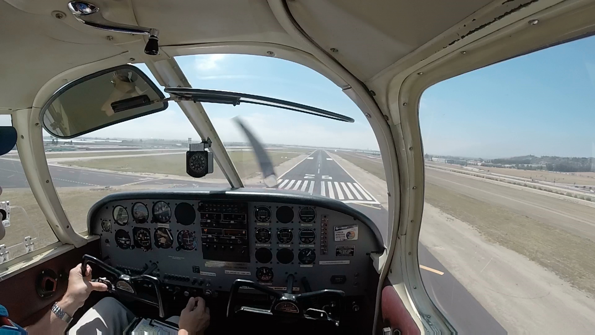
Short final at Camarillo
On my taxi back to the head of runway 26 ground gave me two different options for departure, both turning me back to the east. (I think they are just trying to keep departing planes out of the way of the Oxnard airport which is just to the southwest.) I asked what my other options were and they asked where I was going. I told them Santa Barbara (SBA) and they offered straight out to the coast which was perfect (I thought) as my plan was to go to the coast and navigate along it on the way to Santa Barbara.
I stopped in the run-up area and changed over my flight plan on my knee-board, sent out the obligatory text to my wife and my CFI to let them know I was alive and well, and made one last check of the weather at SBA. After rolling up to the hold short line I contacted the tower and was soon on my way. Immediately after lifting off I was told to contact the Oxnard tower.
Me: “Oxnard tower, Cherokee 5800Uniform, just departed Camarillo.”
Tower: “Cherokee 00Uniform, what altitude would are you requesting?”
Me: “3,000′.” (It is a short flight to SBA so no real reason to climb up higher.)
Tower: “3,000′ approved, VFR climb at your discretion.”
Me: “Climbing 3,000, 00Uniform.”
There were a few scattered, thin clouds ahead at my altitude that started getting thicker before I was going to reach the coast.
Me: “Tower, Cherokee 5800Uniform, I’d like to descend down under the clouds.”
Tower: “You want to go under or over?”
Me: “Under.” (I’m thinking that it’s just going to be a few clouds before the clear skies that the weather report showed at SBA.)
Tower: “Descent approved.”
Me: “Thanks, descending 2,500, 00Uniform.”
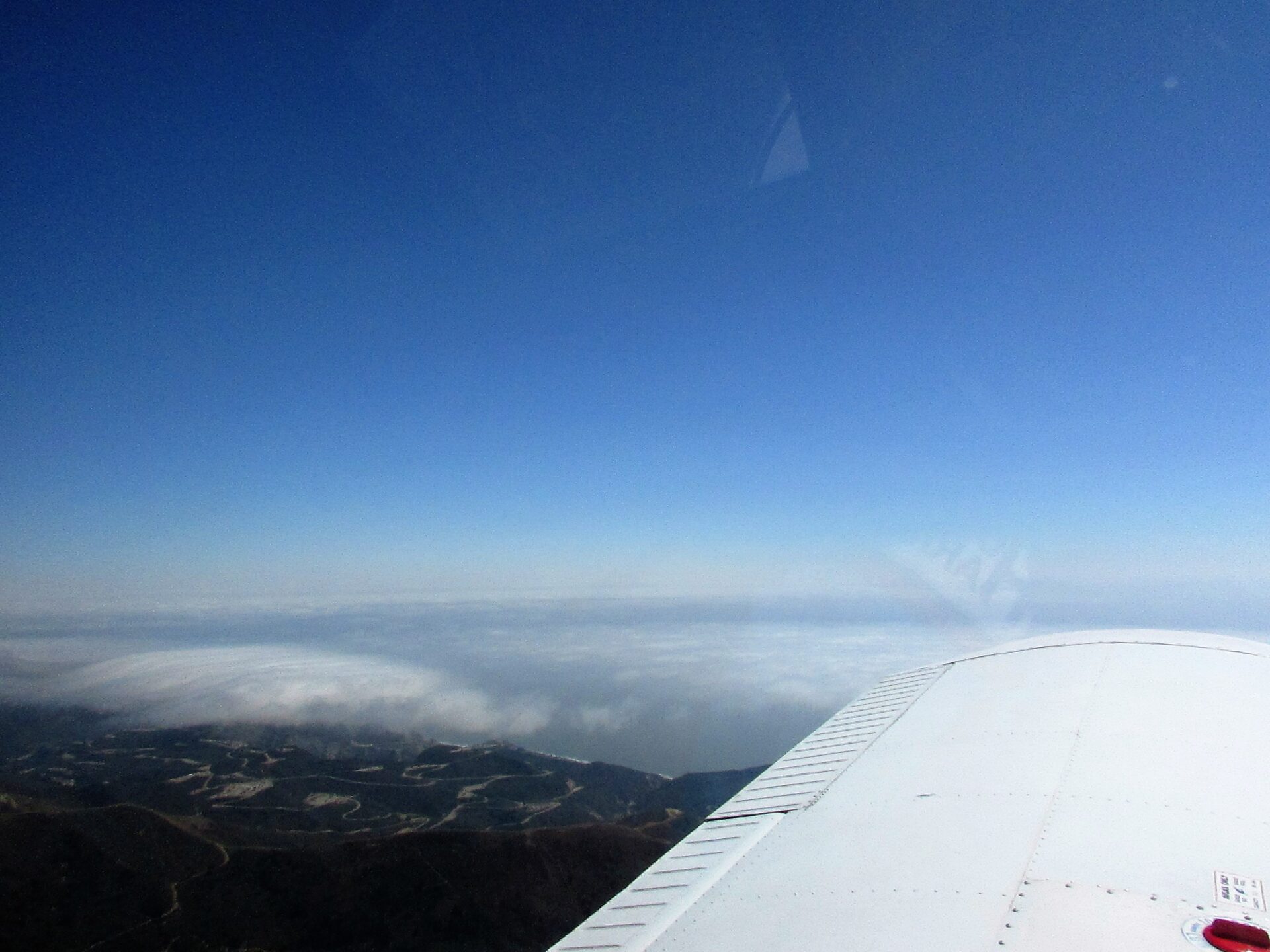
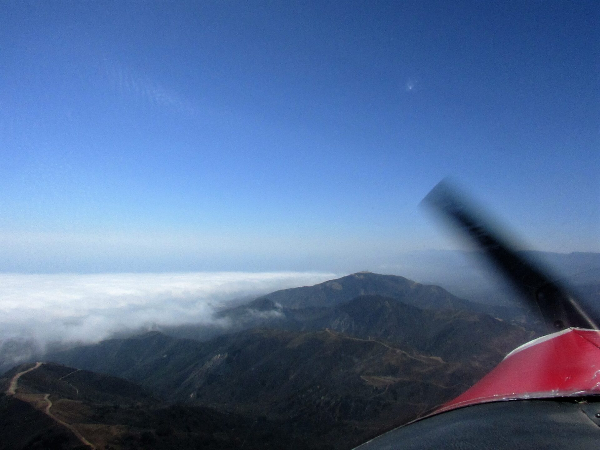
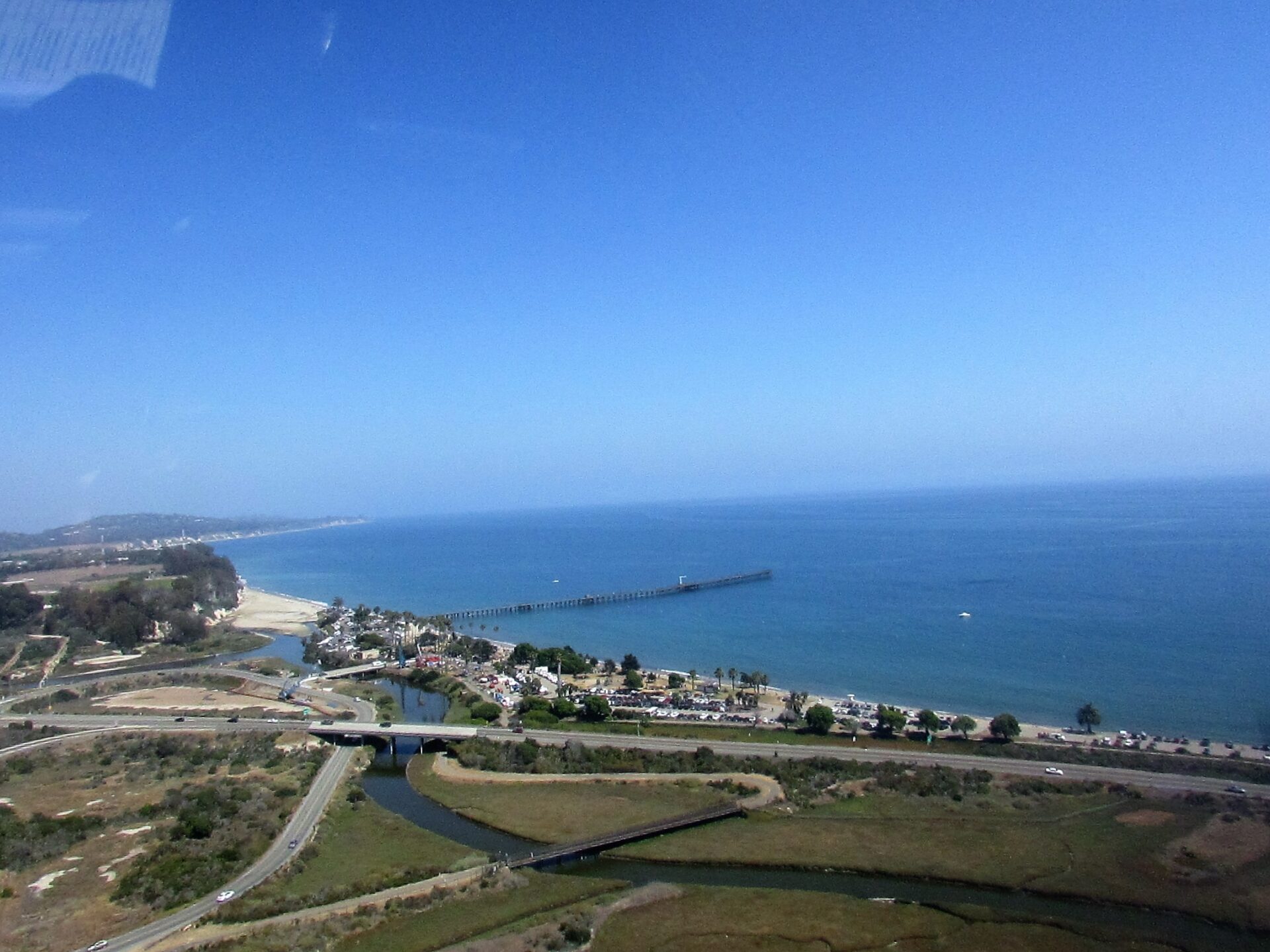
I flew along under the clouds at 2,500′ and as I was passing over Ventura the clouds started getting thicker and lower. I knew I couldn’t continue because I would run out of sky. I also wondered if maybe the 12,000′ ceilings with 10mi visibility that the weather report showed for SBA had changed. That would have been entirely possible with an on shore flow. What if SBA was socked in? I guess I could just turn back and land at Brackett on my way to get in the required two airports so that I would complete the long xc requirements. Anyway, all those thoughts ran through my mind in a couple of seconds and I began an easy climbing turn to the north back where I knew there should be clear skies. A few seconds later I was out from under the clouds and looking back at the cloud bank that I had been about to fly into. I flew the rest of the way to SBA a few miles inland from my planned route, but at least the skies were clear.
Clouds over Ventura
Clouds hanging along the coast
SBA is a Class C airport and the only other time I’ve been to a Class C was once with my CFI when we did some landings at Ontario so I was a little vervous. The winds at SBA were 250 at 6 knots.
Me: “Santa Barbara Approach, Cherokee 5800Uniform, level at 3,000′ about 20 miles southeast of the airport.”
Approach: “Cherokee 00Uniform, squawk xxxx (I don’t remember the number) and follow the 101 for a straight in approach to runway 25.”
(Sweet! Coming straight in with the winds coming right down the runway. But my excitement was very short lived, in fact it only lasted about a second.)
Approach: “Correction 00Uniform, follow the 101 for a left base entry for runway 15L.”
Me: “Follow the 101 for a left base entry for 15L, 00Uniform.” (Dang it… 6 knot crosswind, which isn’t much, I’m signed off to 10 knots, but I would still rather have the winds straight down the runway.)
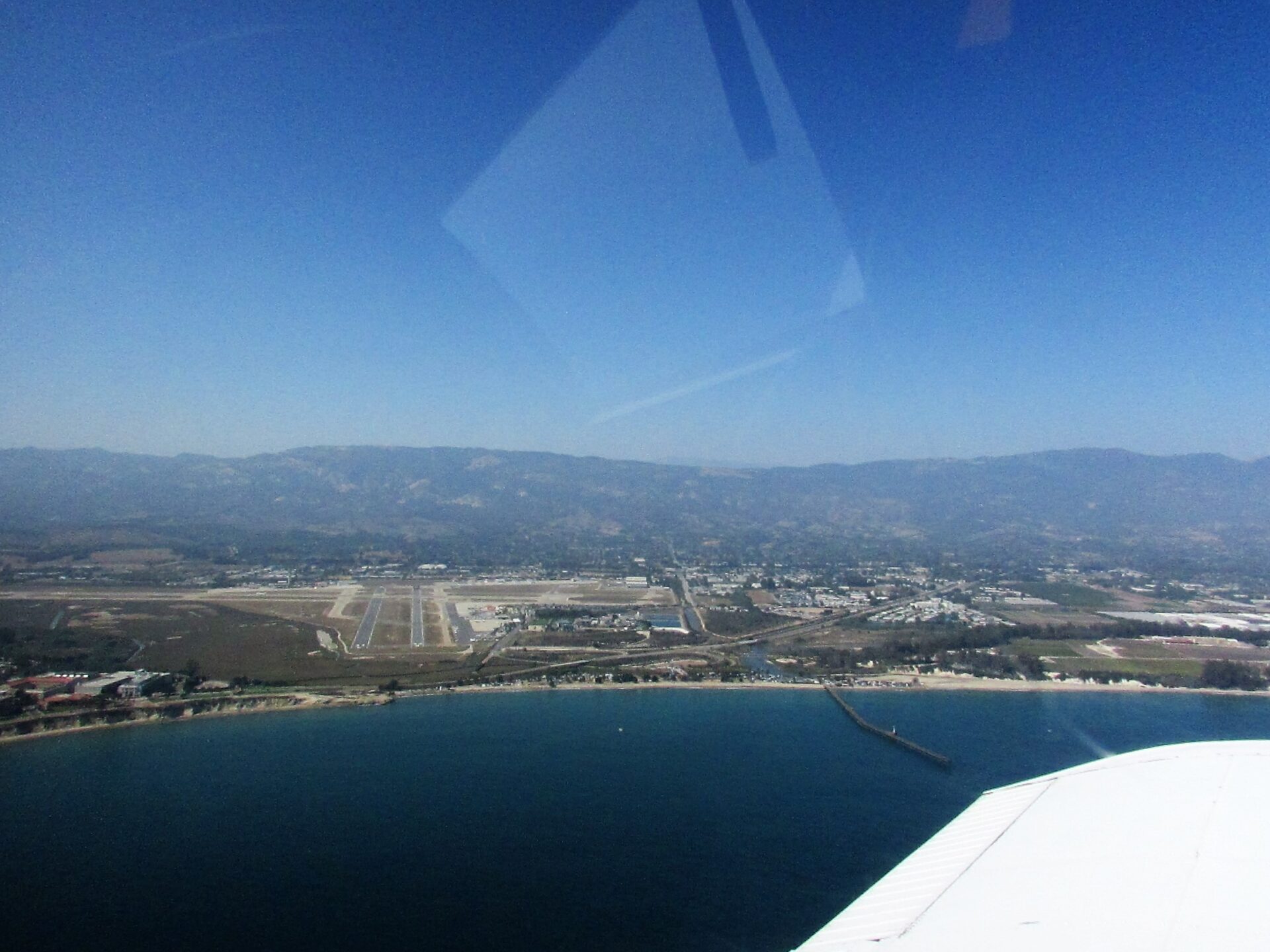
I was handed off to the tower and told to report when 2 miles from the airport. I angled to enter at a 2 mile base and was contacted by the tower that it didn’t need to be a 2 mile base, just to report when 2 miles from the airport and to go ahead and make straight in for 15L. It seems that they like to put the slower planes in on 15R/L and leave 25 for the commercial jets so that they don’t have to try and sequence the slow planes in between them.
Turning final for 15L at SBA
SBA is a really fun airport to fly in and out from, especially if you are using runway 15. As you come in on approach you are headed right towards the coast, and as you depart you go straight out over the Pacific. The Cherokee handles crosswinds fairly well and it settled down on the runway and I exited at taxiway Kilo about halfway down the 4,180′ runway.
Me: “Santa Barbara Ground, Cherokee 5800Uniform clear runway 15L at Kilo, requesting taxi back.”
Ground: “Cherokee 00Uniform, taxi 15L via Bravo, hold short runway 25.”
Me: “Taxi 15L via Bravo, hold short 25, 00Uniform.”
(An inbound jet landed on 25 crossing in front of me.)
Ground: “Cherokee 00Uniform, cross 25.”
Me: “Cross 25, 00Uniform.”
Ground: “00Uniform, will you require a run-up?”
Me: “No, I don’t need a run-up but I do need a few minutes in the run-up area.” (I needed to change flight plans, GoPro battery, get a drink of water, and send the obligatory ‘I’m still alive’ texts to my wife and CFI.)
Ground: “00Uniform there is a run-up area ahead to your right, I have your departure information, let me know when you are ready for it.”
I know I have said it before in my posts, but by and large the controllers that I have dealt with have all been great, super friendly, and helpful and the lady in the tower there at Santa Barbara was great. I got to the run-up area, put on the parking brake, and changed the flight plan on my knee-board for the last leg of my flight.
Me: “Ground, Cherokee 5800Uniform, I’m ready for that information.”
Ground: “00Uniform, runway 15L, depart straight out, maintain at or below 1,500, contact departure 125.4, squawk 7262.”
(It’s a good thing I was taking notes.)
Me: “Runway 15L, depart straight out and maintain at or below 1,500, contact departure 125.4 and squawk 7262.”
Ground: “Read back is correct, when ready contact tower.”
After finishing up I taxied to the hold short line for 15L. Common sense would say that all I had done with the radio was switch the tower frequency to standby when I contacted ground so to contact the tower I just needed to press button to swap the frequencies again. However, I think common sense was still back in the run-up area and not currently present in the cockpit. I took a quick glance down at the flight plan on my knee-board and saw the frequency there for the tower at CNO and that it didn’t match the frequency listed in the standby position on the radio. (It didn’t register I was looking at the wrong column on my flight plan. That’s weird I thought, how did that frequency get there on the radio?). Not only did that not register, but the fact that it was the tower frequency that I use on every flight from my home airport didn’t register either. Still, I made the change and called up the tower…
Me: “Santa Barbara Tower, Cherokee 5800Uniform, holding short runway 15L, requesting departure.”
(If there could have been crickets chirping on the radio I’m sure there would have been. After about 5 seconds I thought ‘That’s odd, no answer, no other traffic on the radio?’ Followed quickly by the realization that I was on the wrong frequency… Face palm… I quickly changed back to the correct frequency and had to wait my turn on a very busy channel.)
Me: “Santa Barbara Tower, Cherokee 5800Uniform, holding short runway 15L, requesting departure.”
Tower: “Cherokee 00Uniform, cross runway 15L, Bonanza on a two mile final, hold short 15R.”
Me: “Cross 15L, hold short 15R, ooUniform.”
I quickly crossed 15L and held up at 15R. Very soon after that I received my clearance to depart and I was headed down 15R for the coast.
Goleta Pier just after taking off
Looking back at SBA after turning crosswind
My flight plan back took me inland over Lake Casitas and Saticoy before meeting up with the route I flew on the way there just east of Camarillo. It was a leisurely flight back with plenty of time to look around and enjoy the beauty of Southern California from 5,500′. When I was close enough to CNO I dialed into the ATIS information and once I could see the airport I let SOCAL know I had the ATIS and the airport in sight. The winds were 270 at 15 knots which are pretty strong but coming almost straight down runways 26R/L. Approach turned me over to the tower and I was told to enter right downwind for runway 26R.
As I was turning base the Tower announced that the winds were now 240 at 13, gusting to 21. The direction and speed of the wind didn’t concern me, but I was a little concerned about the wind gusts. The landing wasn’t great, but it wasn’t terrible. However after touching down on the roll-out I was hit with a gust the kicked me to the side a little and made the wheels chirp. Even taxiing back I had to hold the yoke tight because the gusts kept wanting to push the ailerons and stabilator up and down.
With the my Long XC complete, almost all the major requirements for my PPL are done. After today’s 3.3 hour flight I have two full pages in my logbook and 36.1 total hours. I still need another 1.5 hours of simulated instrument flying to complete with my CFI as well as dialing in my maneuvers. The next couple times I fly will be solo, staying in the pattern and working on my take offs and landings. I also need to finish up Ground School and prep for my written test. The plan is to schedule my check ride for the last part of September. It’s hard to believe that I’m looking at testing for my license just four months after my first flight.