Back in February 2018 we were trying to organize a fly-in for the California Mooney owners. After a fun fly-in to Harris Ranch in May 2017 there was a long dry spell. Enter Phil Corman and Michael Rodgers. Phil offered to host a fly-in for “a few” Mooney’s in Paso Robles which turned into a huge event with a final count of 53 planes! About the same time Michael noticed that there was a club section on Mooneyspace with no clubs, so he formed the West Coast Mooney Club. I noticed the club, joined, and apparently I have the distinction of being the first to join. A great part of the success of the Paso Robles fly-in was because of Michael and his efforts putting together the club and working with Phil.
Fast forward a couple years (has it really been that long?) and Michael put together the West Coast Mooney Club Summer Conference and Retreat to be held at beautiful Sunriver, Oregon. Things seemed to be developing well under Michael’s leadership (I have no idea how he finds the time or energy to do everything) until COVID-19 changed everyone’s plans for just about everything. The event was originally scheduled for June but was postponed until August. Thankfully, Sunriver Resort was able to make everything work within the COVID guidelines from the State of Oregon and it was not postponed again.
It has been a crazy year at work, but I was able to arrange Thursday and Friday off, just my third and fourth days off this year…
Day 1 – Fullerton to Sunriver
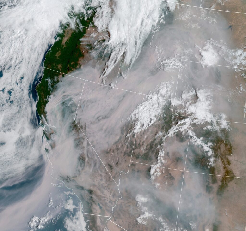
Here we are in August, which means a couple of things for California. First, it is hot and there is rarely a marine layer. Second, it is fire season. Michael had tried to fly up a day early but due to the smoke from several large fires he was unable to get past the smoke near Redding despite going to 14,000’ and ended up turning back, landing in Sacramento, and renting a car to make the long drive to Sunriver. That was an excellent example of sound ADM (Aeronautical Decision Making) despite the desire to get there (get-there-it is).
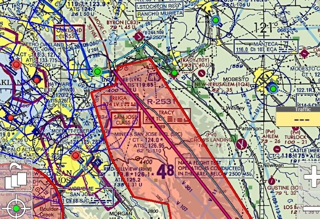
Kathy and I planned to leave early Thursday morning to be there before the afternoon bumps had a chance to develop. After looking at current weather conditions on Wednesday, the direction of the smoke from the fires, and the forecasts for Thursday I planned to make a fuel stop in Tracy and then continue up the Central Valley. If it looked like we would not be able to make it we would instead divert west towards the coast and get upwind of the fires.
The flight there and back would turn out to be my most challenging flights to date, and while it stretched my limits a little, there was no time in the flights that I was nervous or had a “What have I gotten myself into” moment.
After looking at the weather history at various airports during the day I decided that instead of making a fuel stop at Davis (KEDU) as we had done previously enroute to Redding, that we would stop short at Tracy (KTCY). KEDU had been VFR but Travis AFB just southwest of KEDU had been off and on IFR from smoke. KTCY had remained VFR all day and if the smoke to the north that had forced Michael to turn back was still an issue the stop at Tracy would leave open the option to go west around the firefighting TFR (Temporary Flight Restriction) that covered a huge area surrounding Lake Berryessa and was producing immense amounts of smoke. Multiple fires triggered by record numbers of lightning strikes were sending smoke plumes well above 16,000’ the day before.
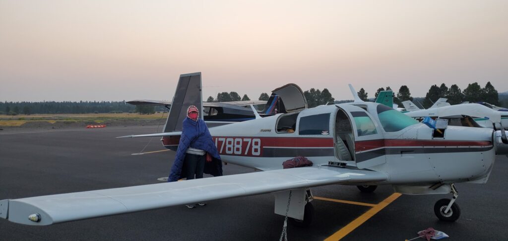
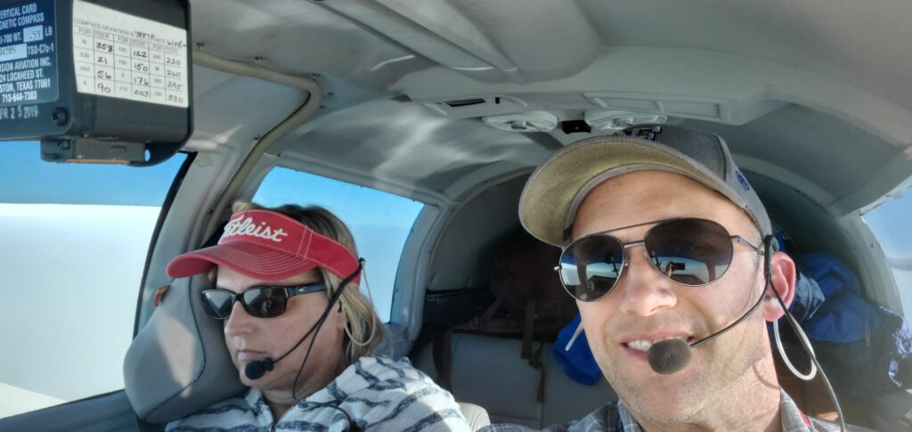
I had gotten an Outlook Briefing the night before and felt fairly confident in the plan while also having alternate options. The alarm went off at 5am, and while I was wishing I had about 30 more minutes of sleep, I also knew I wouldn’t regret getting the flying in before too late in the afternoon. My sister was visiting from Arizona using the “Brown’s Air BnB” so Kathy and I got ourselves ready, finished packing up a couple of things, I got a weather briefing, and we snuck out of the house for the airport.

All Ready 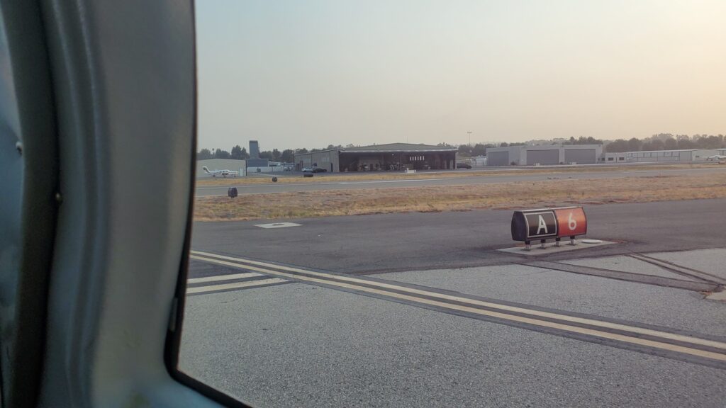
Holding short Runway Six at Alpha
I did pre-flight on the plane and then loaded up our things for the trip. Kathy parked the truck in the hangar and we got in, started up, and taxied down to the run-up area. Everything looked good on run-up and it was five minutes until 7am when the tower would open up. I debated about waiting there for the tower or seeing if I could take off before the tower was open. It was a very quiet morning with only one other plane that had departed about fifteen minutes prior and nobody else on frequency. I decided to taxi down to runway six and see how it would work out. Just before getting to the end of taxiway Alpha the tower came on the radio and reported that it was now in operation and that runway two-four was in use.
Me: “Fullerton Ground, Mooney 78878, we’re down by runway six, do you want us to taxi back to two-four?”
Ground: “Mooney 78878, are you ready to go?”
Me: “Affirmative”
Ground: “I don’t have anyone else right now, you can continue to runway six, contact tower when you’re ready.”
I acknowledged him and continued to the end of Alpha.
Me: “Fullerton tower, Mooney 78878 holding short runway six at Alpha for a northbound departure.”
Tower: “Mooney 78878, left turnout approved, runway six, cleared for takeoff.”
Me: “Left turnout, runway six, cleared for takeoff, 878.”
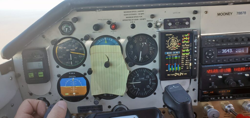
We rolled onto six, I pushed the throttle in, and we were shortly in the air and on our way. Once the Tower gave us a frequency change I called up SoCal Approach for flight following. It was fairly quiet (traffic wise) and we were cleared on our climb up through the Bravo to our cruising altitude of 10,500’. The temperature increased as we climbed and it was getting warm but we eventually were through the inversion layer for a nice cool flight once at cruise altitude.


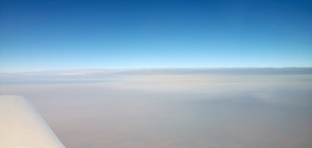
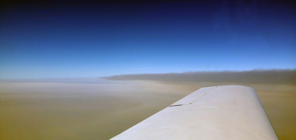
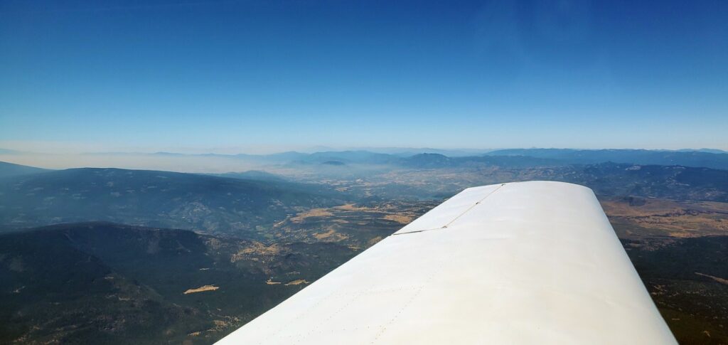
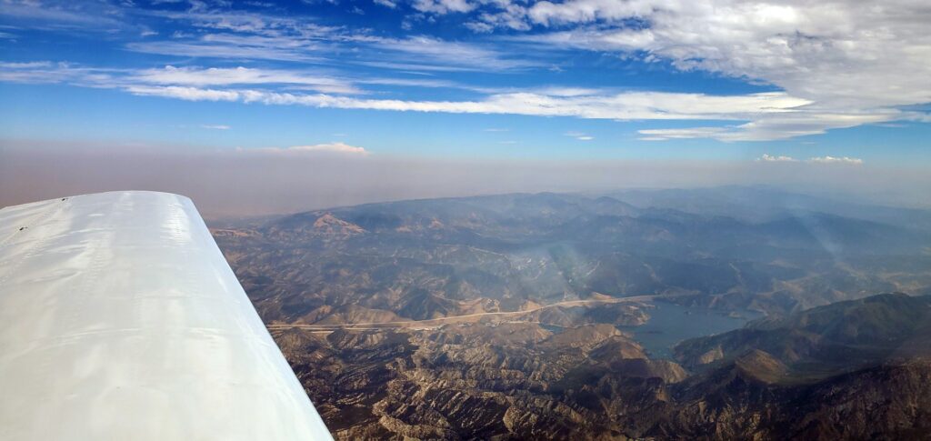
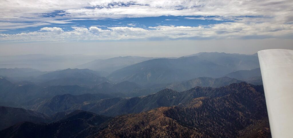
It was smokey from all the fires and there was no visible horizon. We could see ground below us which slowly faded away into gray and that slowly faded into the blue skies. The only way to hold a steady altitude and course was with constant reference to the instruments. I got a taste of how easy it would be to experience spatial disorientation if you were in IMC (Instrument Meteorological Conditions). Without a clear defined horizon and just a haze a slow turn could not be felt and could not even be seen. At one point I was looking at the tablet for probably 5-10 seconds and when I looked back at the instruments we were in about a 10 degree right bank and about 3 degrees nose down, I hadn’t even felt the change.
When I upgraded the engine monitor I also pulled the Turn and Bank Indicator (the gyros in it were becoming more and more noisy) and put in an RCA Electric Attitude Indicator that also has a Slip/Skid and Turn Rate built in along with a 4 hour battery back-up. If I did not have that we would have had to turn around and scrap the trip when I noticed the vacuum gage was ready zero, the vacuum pump had given up the ghost. I watched as the vacuum AI (Attitude Indicator) slowly started leaning which progressed to a wobble and the vacuum DG (Directional Gyro) started processing more rapidly until it was just spinning. The AI is not required instrumentation for daytime VFR flight and while we were technically VFR (it sure is easier to spot other planes against the smoky background than all the ground clutter) the lack of a horizon as previously mentioned required constant attention to the instruments.
We began our descent into Tracy and found ourselves in and out of smoke layers, some were very thin and others the smoke was thicker with diminished visibility. Oakland Center must have been busy, ATC will usually cut you loose from flight following as you get close to the airport but at five miles out with the airport in sight I hadn’t been given the frequency change. We had been monitoring the Tracy CTAF to get a picture of the traffic and I called up and told ATC I had the field in sight and was going to squawk VRF and change to CTAF. I changed my transponder setting, switched frequencies, and started making position calls. There was one other plane that was just doing pattern work and we fit in behind him for a nice landing and then taxied to fuel.
After a restroom break, fueling up, and checking the weather for the next leg of the trip we climbed back in the plane. While it was very smoky to the south where we had come from courtesy of a large fire burning in the hills to the southwest of the field, off to the north and northeast we could see blue skies.
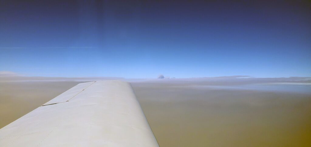
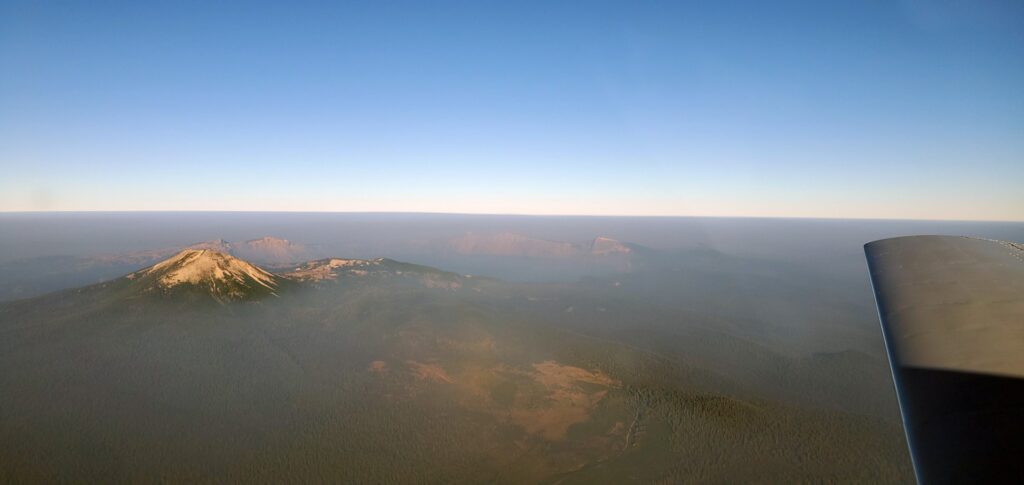
Shortly after takeoff I called up Oakland Center again to pickup flight following and on our way. Approaching Red Bluff/Redding I could see that the smoke layer that had turned back Michael the day before when he wasn’t able to get above it at 14,000 was right at our altitude so I began a climb to 11,500 which put us right at the top of the layer. If 11,500’ wasn’t going to be high enough my next option was to deviate East (we had plenty of fuel for the trip) where I could see that the smoke was thinning out and could see blue skies and the mountains. Once at 11,500’ I knew we were fine as I could clearly see Mt Shasta even though it was almost 100 miles away.
Columns of smoke 

Mt Shasta 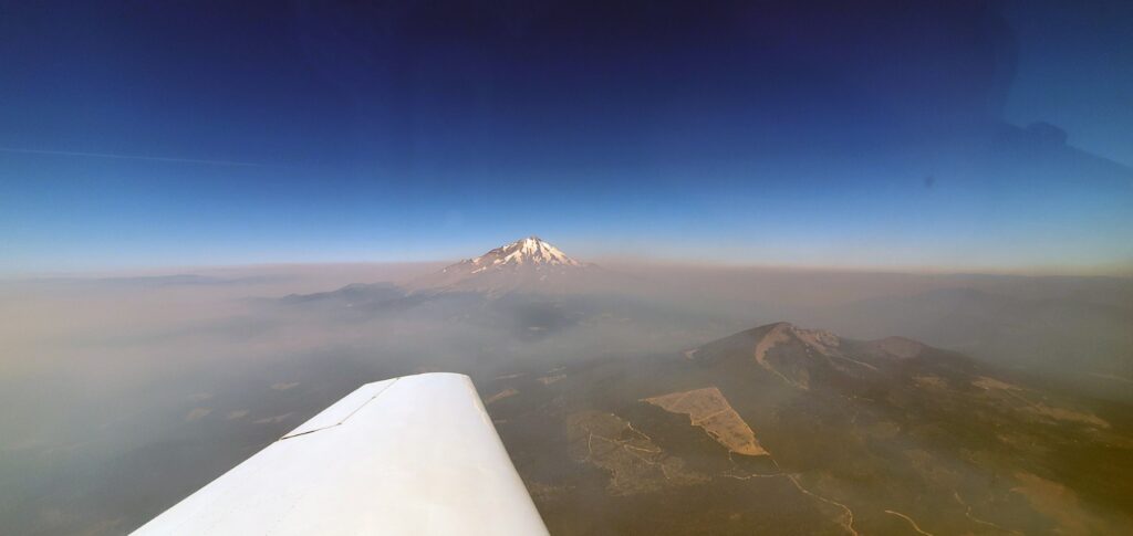
Mt Shasta 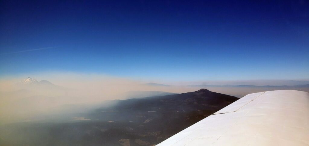
Leaving the smoke behind 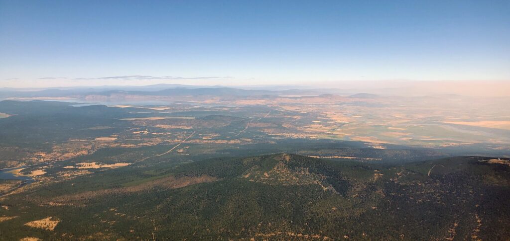
Klamath Falls
We passed Mt Shasta off our left wing and with the skies clearing out descended back down to 10,500’. There are a few places on my “Flying Bucket List” that I have wanted to fly over and see from the air, one of those is Crater Lake in Oregon. A couple days ago Kathy had sent me a text with a picture of Crater Lake asking if we could fly over it on our way. I took a look at the maps when planning the route and it was only a short detour in the flight plan so after passing Mt. Shasta we went direct to Crater Lake. The lake is beautiful with the most incredible deep blue water and I was grateful for the opportunity to fly over.

Crater Lake 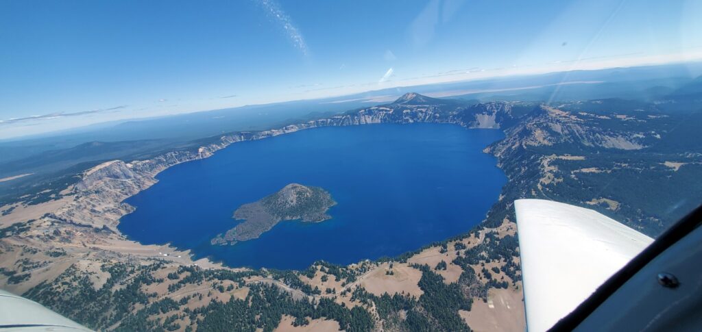
Crater Lake 
Crater Lake
What had been a smooth flight most of the way was no longer smooth as we began our descent into Sun River. Pulling power back to get back into the green arc on the airspeed indicator still left us with a bumpy ride down. The Deschutes River Valley is beautiful with the river winding its way through the Ponderosa Pines and what from the air looks like green grass fields but which in reality are fields of reeds.

Deschutes River Valley 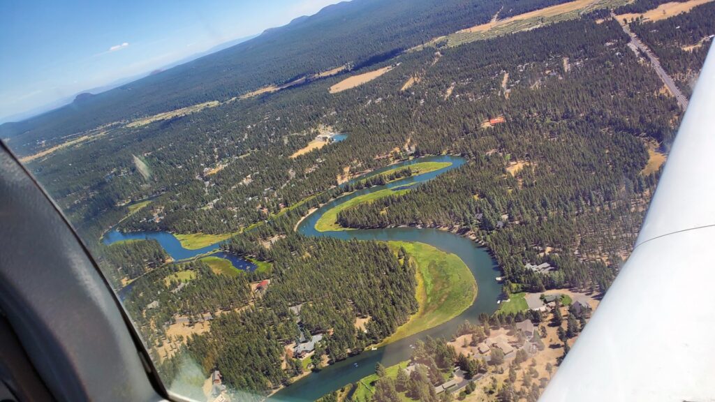
Deschutes River 
Sunriver Airport (S21) 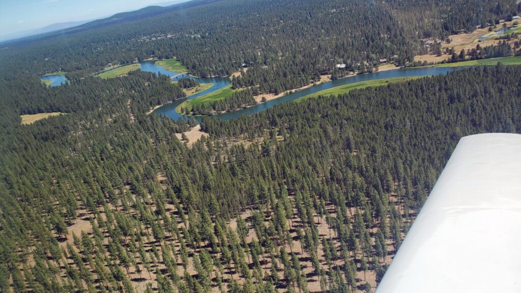
Deschutes River 
Turning Base – Runway 18 – Sunriver (S21)
I misjudged the wind slightly on the right downwind leg to runway 18 and was closer than I wanted to be to the runway so angled slightly away before turning base and final. Kathy took a great picture as we turned base and you can see the airport, the marina and the stables (none of which I noticed as I was busy flying the plane). We exited the runway and someone on Unicom let us know we would have to back-taxi on the runway to get to the ramp as the taxiway was currently under construction. There was another Mooney on a straight in final.
Me: “Mooney on final, how far out are you?”
Mooney: “We’re about four miles, you have plenty of time.”
Me: “Sunriver traffic, Mooney 878 back-taxiing runway 18.”
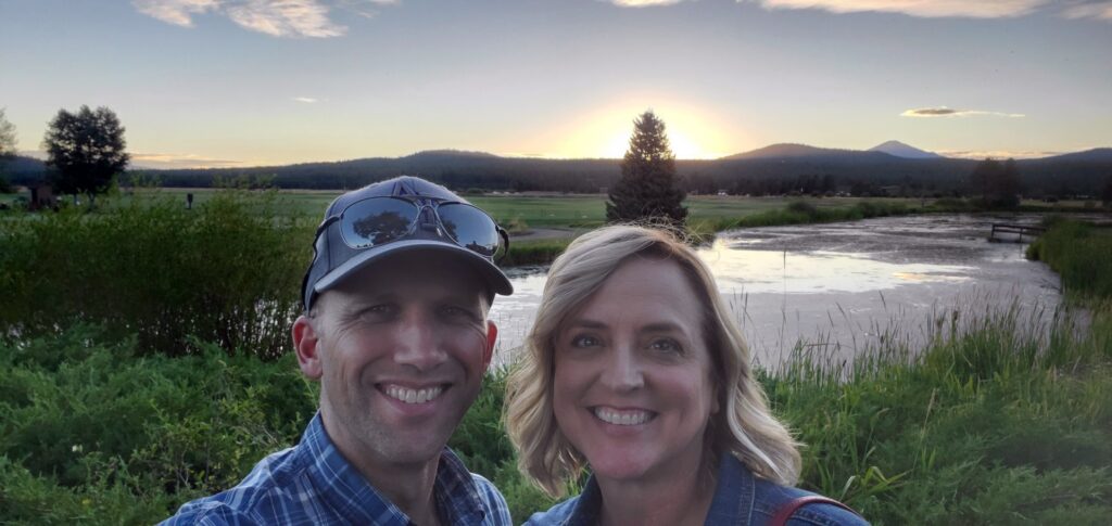
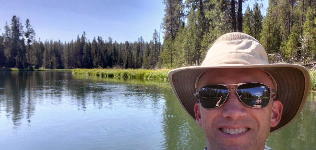
We were back down the runway, exited with lots of time to spare, and were directed to a tie-down spot on the new ramp that had never been used. As we were climbing out Michael and Shannon were walking across to greet us and the others that were arriving having just finished a horseback ride. I tied down the plane and we climbed into the resort bus for a ride to check in at the lodge and go to our room. The rooms are very nice and we had one on the second floor looking out through the pines to the 11th fairway of the Meadows Course.
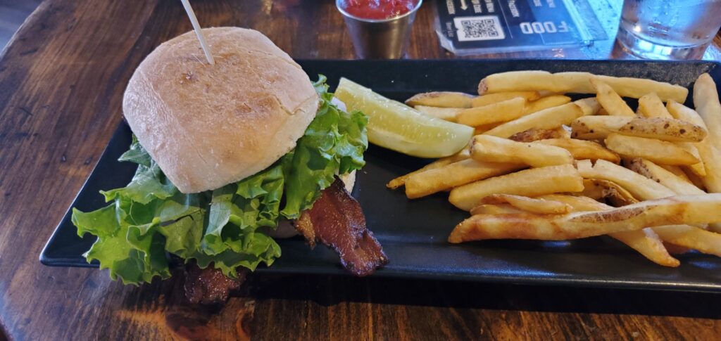
Once settled in it was time for a late lunch. A short walk to the Lodge had us sitting on the patio of Carson’s looking out over the driving range at the mountains on the west side of the valley. The burger was average, the fries were excellent. After a short nap (we did get up at 5am) we went back over to the Lodge and had the chance to meet up with a bunch of other Mooniacs to visit and get to know folks. It was wonderful to sit there in that beautiful setting and just talk about Mooneys and flying.

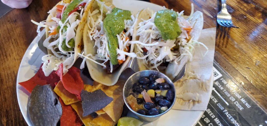
We stopped for a quick picture on our way over to The Village where we were looking for some dinner and some food supplies from the market. There were lines at all the restaurants but we ended up at El Caporal for some Mexican takeout which we took back to the room. It was excellent.
Day 2- Conference Day
The resort had everything setup at the Homestead building in keeping with the State’s COVID rules. There were tables setup six feet apart with either one person (or couple) to a table. Michael had arranged for a great lineup of speakers and presenters.

Homestead Room One
- LASAR – Brett Stokes & Dan Riesland – Mooney Speed Mods & Parts
- Crew Chief Systems – Aaron De Zafra – Modern Aircraft Management
- Thunderbird Aviation Sales LLC – Richard Simile – Aeronautical Decision Making & Mission Rules
- Special Announcement – Jonathan Pollack – The Future of Mooney International
- Airspeed Insurance – Parker Woodruff
- Don Maxwell Aviation – Don Maxwell

Homestead Room Two
- Right Seat Ready Class – Jan Maxwell

Halfway through the day there was a catered lunch out on the lawn which provided more opportunities to meet people and talk about Mooneys and flying. I loved all the presentations and learned something from all of them. Kathy really enjoyed the Right Seat Ready class and learned a great deal.
There was some time after the presentations to wander around or do whatever before meeting back at the Lodge for a ride to the airport for the Parade of Planes to see all the different Mooneys everyone flew in. There were a bunch of folks sitting in front of the Lodge when Kathy and I walked up waiting for the resort bus. I saw Richard Simile pull up in his little rental car and walked over to say hello. As a joke I said, “If everyone is going to fit in here, we’re going to have to sit on laps.” My feeble attempt at a joke began what would be a great, memorable evening. Richard said “Get in, let’s go!” I told him I was just giving him a hard time but again he told Kathy and I to hop in so we did and we were off on our way to the airport. I’m not sure how long everyone was at the airport, time flies when you are walking around looking at planes, but it was great! Eventually we climbed back in with Richard and went looking for some dinner along with Don and Jan Maxwell and Keane who was riding with the Maxwell’s. Keane had flow all the way from New Mexico for the event.

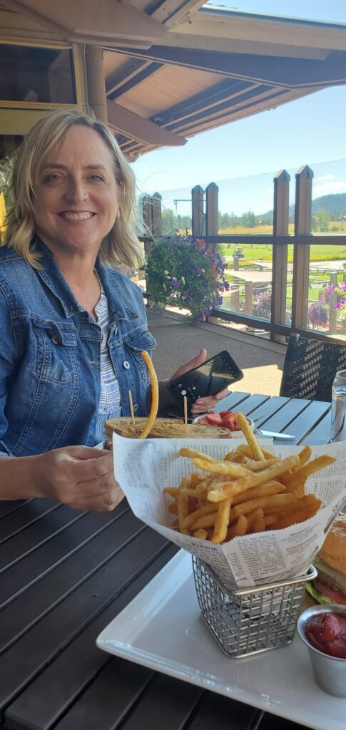
Originally, we tried stopping at the Sunriver Brewing Co but the wait was too long so we ended up back at Carson’s. Instead of the burger I went with the club sandwich. If you find yourself at Carson’s, I recommend the club! The dinner was good, but the conversation was excellent. I’m not sure I contributed much to it, how can you when you are sitting with legends like Don and Jan Maxwell and Richard Simile. We had the privilege of listening to story after story from them for the rest of the evening. It was amazing, I think we closed the place down.
Day 3 – Resort Day
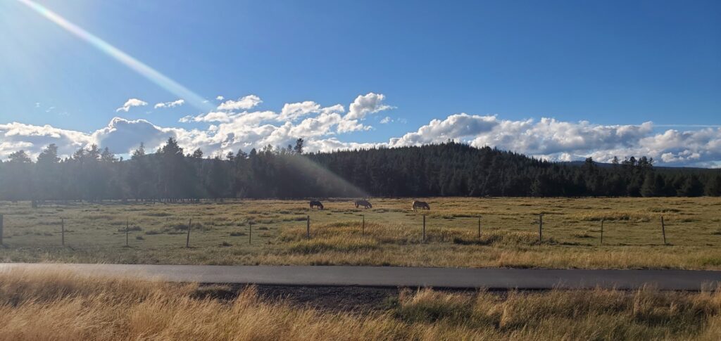
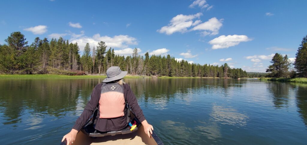
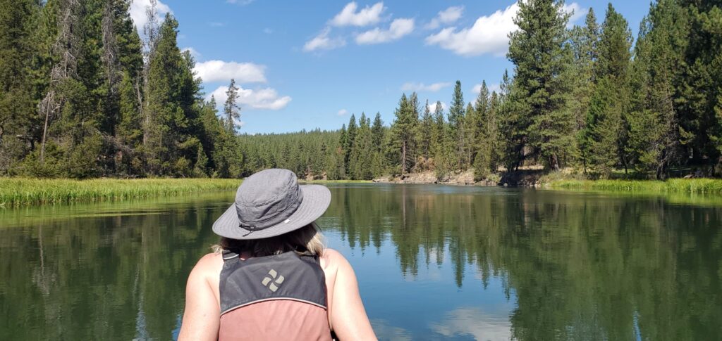
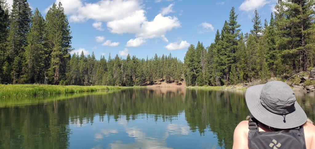
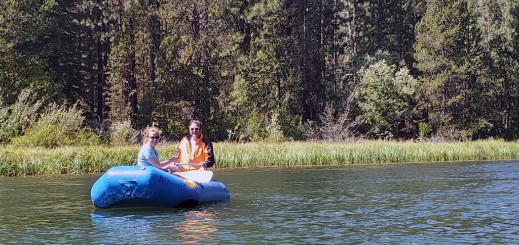
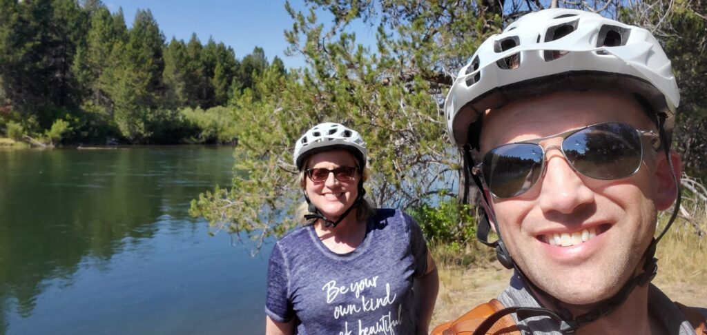
Michael had planned the event to try and provide something for everyone. The Conference Day provided lots of great information, but he wanted this to be something for the whole family to enjoy so Resort Day was a day to enjoy doing whatever you wanted. In the morning Kathy and I went to the Marina and got a canoe for a float down the Deschutes. It is a six mile float through some of the most beautiful country. The water is smooth with a gentle current and it was a wonderful way to spend the morning. Just before the end of the float we caught up to Michael and Shannon who had taken a raft down the river. At the end of the float the Marina gives you a ride back up to the starting point.


For an afternoon activity we went and rented bikes for a ride around the resort. Just an FYI, the shortest time they rent the bikes for is 24 hours so if you are going to rent a bike keep that in mind so you get the most for your money. The resort is fairly flat so the bikes are a great way to get around without much effort. We rode to the village for lunch at the Sunriver Brewing Co (it was good but Carson’s was just as good and has a better view for pretty much the same price) and then we went for a ride around the resort. We took the trail down towards the Marina, along the river west of the airport, and then back to our room to relax before the evening festivities.
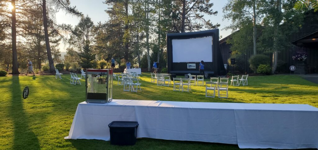
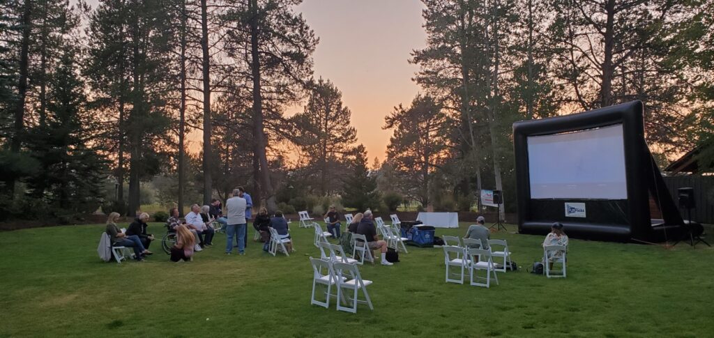
To cap off the weekend event Michael planned a movie night on the lawn in front of the Homestead Building. There were the awards from the Parade of Planes, pizza, salad, fruit, and popcorn. He had arranged for a copy of “Flying the Feathered Edge: The Bob Hoover Project.” I don’t know how many had seen it before but this was a first for me. The movie is very well done and one I would enjoy seeing again. We said our goodbyes to everyone as we planned to leave early in the morning and walked back to our room.

Day 4 – Sunriver to Fullerton
I had been looking at forecasts and satellite pictures of the smoke all day on Saturday to plan our flight back. Instead of flying straight back down the central valley I decided to detour to the west to stay out of the smoke coming from the fires burning in the Mendocino National Forest where a record number of lightning strikes had sparked the fires that created the smoke that turned back Michael at 14,000’ near Redding on Wednesday and pushed us to 11,500’ on Thursday. Once past those fires and the TFR we would stop again in Tracy for fuel before departing Tracy to the northwest to climb out and loop west of the fire burning in the mountains southwest of Tracy before turning to the southeast and towards Fullerton (KFUL).
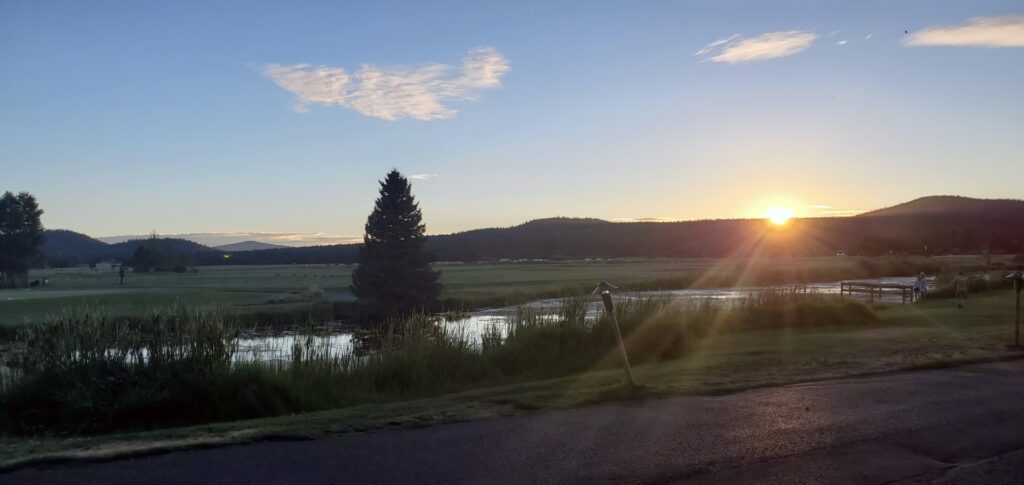
We got to the airport early and watched as the sun came up over the horizon as a dull red ball through the smoke which was now beginning to cloud the skies of Sunriver. It was chilly with the temperature hovering at 41 degrees and some morning dew on the wings. Keane got there before we departed to get an early start on his flight back to New Mexico.
41 Degrees is Cold 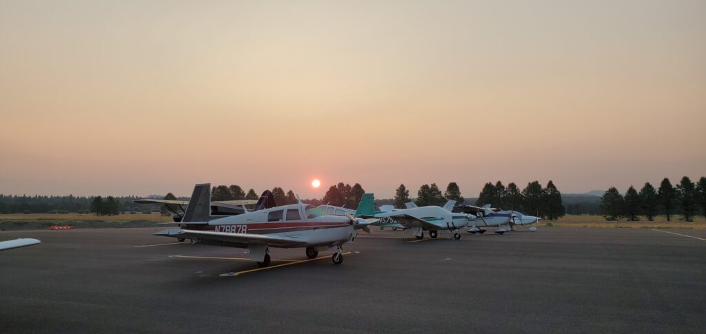
Sunrise through the smoke
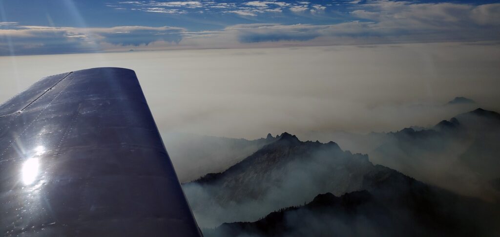
After pre-flight, letting the engine warm up, and run-up we waited for a helicopter that was in the pattern to depart before taking runway 18 and climbing out to the southwest. It was again very smokey/hazy and while we were on top of the smoke at 10,500’ it still required attention to the instruments to stay straight and level because there was no visible horizon, just a blur where the ground went to smoke and the smoke went to blue skies with a mountain top poking above it here and there. I was glad we had flown over Crater Lake on the way there because on the way back you could barely see the peaks that surround the lake sticking up through the smoke.
Crater Lake hidden by smoke 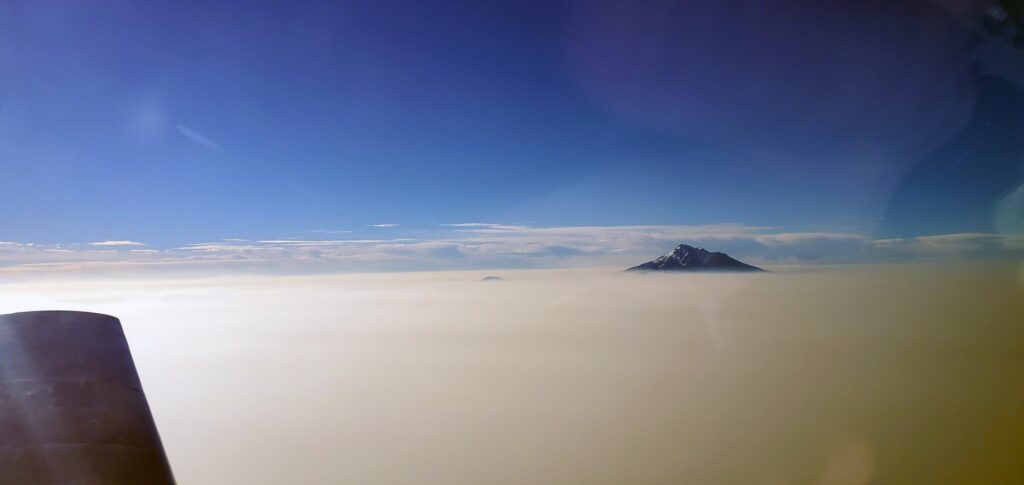
Mt Shasta 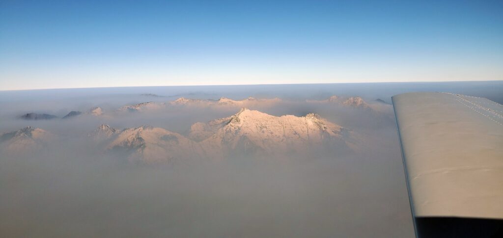

For a moment as I looked to the south I considered changing my plans to detour to the west and head straight down the valley, I could see a long way and it did not look like the smoke was as high as a few days before. After some internal discussion in my mind I decided to stick to the current plan where I knew we would pass west of most of the smoke and about an hour later as we were passing west of the fires and I could see how high the smoke was reaching I was glad I hadn’t changed the route.
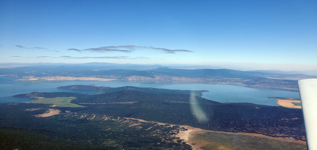
Throughout the flight I kept an eye on the weather at Tracy to know if we needed to divert to a different airport for a fuel stop. I considered stopping at Lampson Field (1O2) in Lakeport, the home of LASAR, for fuel but Tracy had been reporting clear below 12,000’ and alternating between 5-6 miles visibility the whole flight so we continued on. There had been hope that we might get a glimpse of San Francisco as we went by but that was not to be with morning low clouds hanging over the city.

Clear Lake, CA 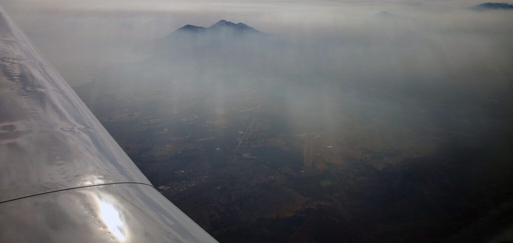
Lampson Field (1O2) 
Approach temporarily held us above 5,000’ on our descent into Tracy for a Cessna heading north which we easily spotted against the white/gray smoke below. Once past his line of flight we were cleared to continue our descent. Not all visibility is created equal, and while it was maybe 5 miles visibility on the ground at Tracy it was not 5 miles visibility between 2-4,000’. We never lost sight of the ground or sun, but I’m not sure how much forward visibility we had, I don’t think it was any more than the 3 mile minimum for VFR.

We took a restroom break, fueled up the plane, and found that the airconditioned lounge was locked although it had hours of operation for Sunday so instead we found some shade to sit in while looking at the forecast and briefing for the last leg of the trip. Taking off on runway 30 and departing to the northwest had us climbing into the reduced visibility again before getting above all the smoke. I picked up flight following again and once we were above 5,000’ and the TFR we made a turn to the southeast. ATC held us below 6,000’ for some passing traffic and then cleared us to our cruising altitude of 9,500’ where we moved along with a little bit of a headwind but still maintained a fairly respectable 155-160mph ground speed.

Finally, as we left the Central Valley and approached the San Fernando Valley that the skies started clearing up enough to allow navigation by looking outside. It doesn’t seem to matter how much I fly, I am still amazed when I look at how far we still have to go and yet only see 20 minutes or so remaining in the flight. As we passed over Van Nuys we were only ten minutes from landing in Fullerton. What would have been a 13 hour drive was instead 6 hours of flying, I love the Mooney. What a great plane, and what a great weekend. A huge thank you to Michael for all of his tireless work to put together an amazing event, I can’t wait for next year’s!